Reveal’s model of proactive subsurface risk management
This post was originally published on this site
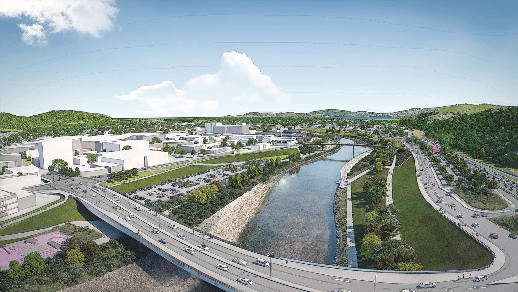
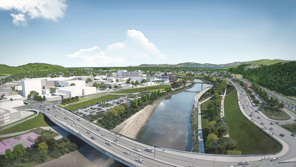
Lower Hutt is an urban centre of around 110,000 people, a short distance north of New Zealand’s capital city Wellington. The city has outgrown its roots as a manufacturing hub and commuter suburb for Wellington into a thriving business and residential centre and is defined by the winding river that flows down the Hutt Valley (Heretaunga).
RiverLink is a partnership between Greater Wellington, Waka Kotahi, Hutt City Council and iwi Taranaki Whānui ki Te Upoko o Te Ika and Ngāti Toa Rangatira to deliver crucial flood protection and river restoration work, improvements to public transport, walking and cycling routes, local roads and the State Highway Two Melling Interchange, as well as urban revitalisation of the Lower Hutt city centre.
Te Wai Takamori o Te Awa Kairangi engaged Reveal in December 2022 to complete a comprehensive utility model that could be used to plan further investigations and inform partners on the status of the underground utilities within the planned project footprint.
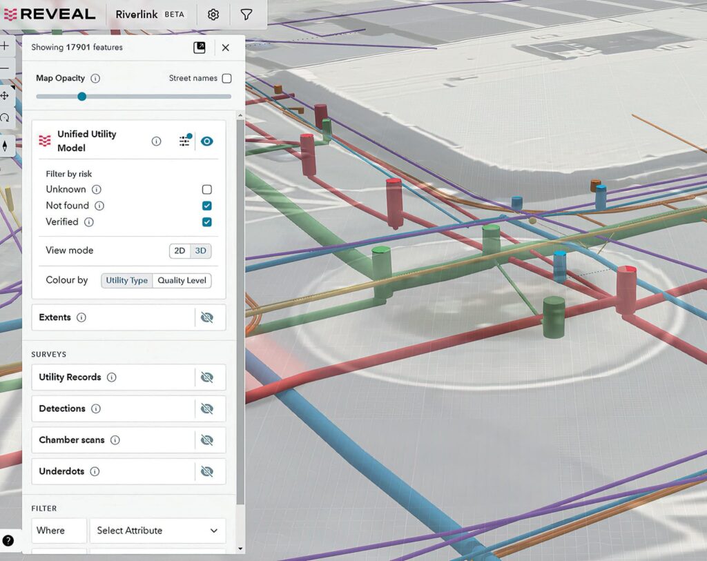
The work was completed in two stages, with the first stage involving a comprehensive 2D desktop study. Reveal’s team compiled information from various sources, including road corridor managers and utility providers to ensure the data was up to date.
This foundational model was built on accurate readily available information.
Following the desktop study, Reveal performed a Ground Penetrating Radar (GPR) survey.
Related stories:
The GPR data was processed and used to update the model from 2D to 3D, providing an even more accurate and complete understanding of the subsurface infrastructure by adding crucial depth measurements to the model.
Samantha Smith, Project Manager – Utilities for Te Wai Takamori o Te Awa Kairangi says one of the standout features of Reveal’s model is its versatility.
“The model can be exported in various formats, making it compatible with our design software. This compatibility enabled seamless integration of the model into our planning and design processes, making it an invaluable tool. The visual presentation of the model is impressive, and the user interface is intuitive and easy to navigate,” Smith says.
The Reveal team took only three months from project inception to delivery of a fully-fledged Unified Utility Model in Reveal’s web-based platform – Undermaps – for Riverlink’s designers and engineers to work with.
“One of the most significant benefits of using the Reveal model is its potential to reduce the need for invasive investigations. By highlighting unknowns and higher-risk areas, the model allows for targeted investigations and utility relocations planning. This approach minimises disruptions and costs associated with more invasive methods,” Smith says.
“Reveal has proven to be innovative and forward-thinking in their field. Their diligent and thorough approach, coupled with the creation of a visually appealing and user-friendly model, has enabled us to plan further investigations, and inform our relocations design with confidence.”
This article was originally published in the October edition of our magazine. To read the magazine, click here.
This article was originally published in the October edition of our magazine. To read the magazine, click here.
This article was originally published in the October edition of our magazine. To read the magazine, click here.
This article was originally published in the October edition of our magazine. To read the magazine, click here.
This article was originally published in the October edition of our magazine. To read the magazine, click here.
This article was originally published in the October edition of our magazine. To read the magazine, click here.


Responses